In your screenshots you have options to ‘Open in Chrome’ and ‘Open in Safari’. That suggests that you’re not using either of those browsers.
Please try both Chrome and Safari and Add to Homescreen from whichever one works. They both work for me.
In your screenshots you have options to ‘Open in Chrome’ and ‘Open in Safari’. That suggests that you’re not using either of those browsers.
Please try both Chrome and Safari and Add to Homescreen from whichever one works. They both work for me.
You sir are a star working spot on through Chrome.
Thank you for your assistance very much appreciated ![]()
@SimonDale just noticed the improvements on SSSI’s, thank you that is really helpful.
There is an SSSI not too far away from me, it doesnt affect drone flight but its super handy to be able to check.
I’m glad it’s helpful. It was fun wrangling the SSSI data in and getting it to show nicely.
Without showing what’s in the SSSI, it’s a bit useless - so we do!
Hi Simon, thank you so much for all your hard work in filling the breech after droneAssist went into administration. It was a good tool and well respected. Best wishes to you and your team.
I have managed to install the app “TheDroneMao on my phone ![]() — Ken
— Ken
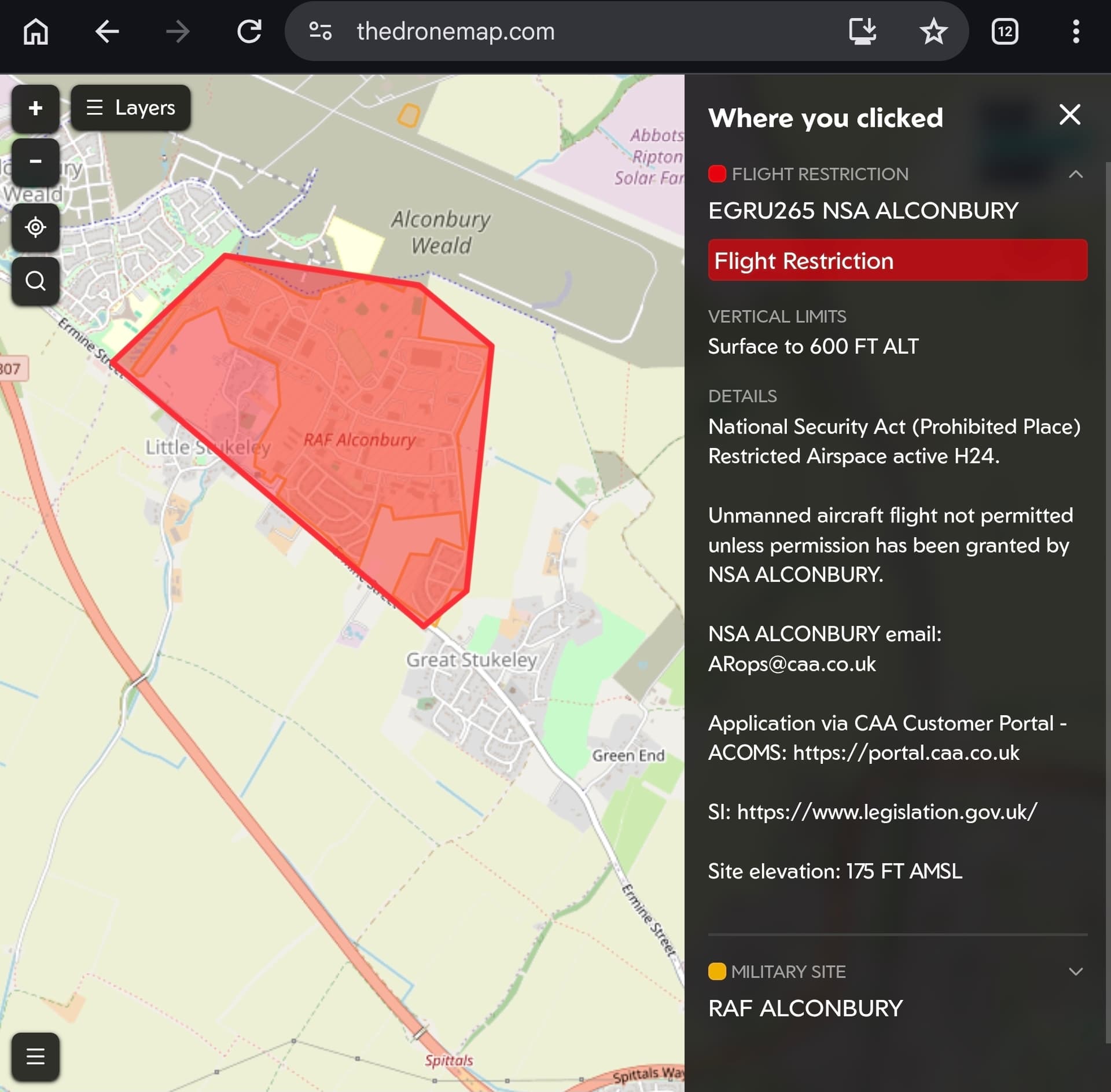
@SimonDale Can you add the recently released list of prohibited places? https://www.legislation.gov.uk/uksi/2026/64/pdfs/uksi_20260064_en.pdf
Thanks
Hi Adrian
Yes, these will be added.
All the best
Simon
Fabulous. Thanks Simon.
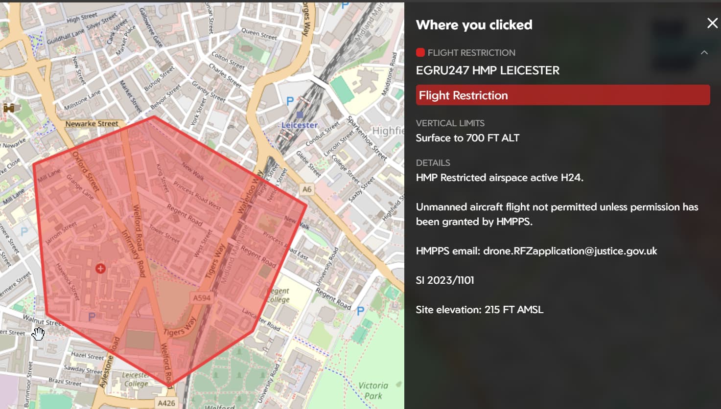
Leaving aside the issues most of us have with ‘auditors’ DJ audits has for a change produced a more worthwhile video (posted three years ago but just seen it) at The Air-One Veritport, in Coventry. At the event a West Midlands Police drone squad officer confirmed as per the data then on DroneAssist that the NFZ covering prisons - or at least HMP Leicester, in the example given - only applies up to 164ft.- at 37’11" in https://youtu.be/2rpti4Ve1Wg?si=9noaeDvWQroWYlVb the data in the TheDroneMap just says ‘from the surface’. Have prison FRZs changed since then or does TheDroneMap prison FRZ data need a tweak?
Thanks Adrian.
Our prison FRZs now show the heights from the AIP. They’re all over 400 ft so it doesn’t make any difference, but good to have it correct.
I guess it changed, so we can’t drop the erm skag to our homies from above ![]() .
.
Thanks Simon
Thanks Simon, nice touch adding the site’s ASL to deal with our overlords using ASL rather than AGL.
Adrian
I open drone map through a browser(brave) on my phone,no problem there
What i’d like to know is,is there a way to change from feet to metres when zooming in/out ie height
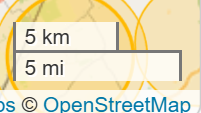
Also be nice to see a map distance scale somewhere ie miles/Km’s
Thanks
Hi @shedendman
If I understand you correctly, no - feet is the correct unit for height/altitude and that is what NOTAMs, etc are published in.
There is a scale in metres and feet in the bottom right corner - perhaps it doesn’t show on your screen with a small screen size?
yes it shows,when you zoom in and out,which is rather funny,as you can zoom in to 100(30.48m),200(60.96m),300(91.44m),NO 400(121.92m,isn’t that over the 120m restriction?) ,next is 500
I wasn’t referring to height i was referring to distance ie as the crow flys
Plus the CAA mostly state M and feet in brackets
The scale in the bottom right is not height. It is distance - as the crow flies.
This is in the bottom right in miles/feet and km/metres.
Did everyone get our email?
@Louis.fpv Yes just recently got mine thank you ![]()
![]()